 ESR14: Reduction of uncertainty through regularized, automated road infrastructure inspection, using unmanned aerial vehicles
- Host: University College Dublin (UCD)
- Address: School of Civil, Structural and Environmental Engineering; UCD, Newstead, Belfield, Dublin 4, Ireland
- Main Supervisor: Prof. Debra Laefer
- Fellow: Siyuan Chen
Road inspection, repair, and the affiliated time delays due to traffic jams can significantly impact a country’s gross domestic product. To reduce these costs, an inexpensive, reliable, non-intrusive road monitoring is needed to enable local governing authorities to identify and monitor small road defects. Instead of large-scale repairs, the extension of a road’s life could arguably be achieved with the allocation of substantially fewer resources.
If this is achievable, it makes sense from several perspectives: economically – in terms of direct cash expenditure; and environmentally – in terms of only repaving where it is absolutely necessary. The key to such an approach is rapidly, regularly, and inexpensively acquiring such data and automatically detecting emerging defects. To address this problem from the ground is simply inefficient, as each kilometer of road would have to be driven for every inspection. Aerial laser scanning offers the necessary resolution for defect detection, but at a high cost per square kilometer (> €2,000/km2). This technology also requires aviation authority approval for each flight, thereby making regular data collection cumbersome.
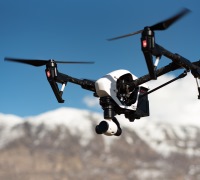
As alternative, unmanned aerial vehicles (UAVs) offer satellite imagery’s low cost combined with aerial laser scanning high accuracy. While the term UAV encompasses a large range of commercial options weighing as much as 40 kilograms, there is a class of the devices that weight on a couple of kilograms. TRUSS will investigate the use of these devices (i.e., ebee Sensefly UAV shown in the figure) for monitoring road condition.
The recruited ESR, supported by UCD expertise in aerial laser scanning, will follow the methodology: (1) create a set of algorithms to programme multiple UAVs to maximize efficient data capture and minimize overlap and occlusions for road monitoring; (2) establish options for synchronization to allow time specific positioning to allow such things as traffic changes; (3) develop a graphical user interface (GUI) appropriate for control of multiple UAVs, and (4) devise a means for temporal-based change detection for automated defect identification and characterization.
You can follow blog and publications by ESR14 below.